Defying Dimensions: How a New Zealand Transport Agency Leveraged Digital Intel To Connect Physical Worlds
Te Ara Tupua is a transformative project by the New Zealand Transport Agency that set out to achieve its goals, without sacrificing the natural ecosystem. The aim: enhancing transport resilience and creating a safe walking and cycling link between Wellington and Lower Hutt. Utilizing innovative construction techniques and digital workflows, the project managed to integrate cultural and environmental considerations, ensuring precision and efficiency. The use of Trimble technology has significantly improved block placement accuracy and productivity, while providing stakeholders with real-time visibility into the project's progress.
The Te Ara Tupua Alliance, which includes NZ Transport Agency, Downer NZ, HEB Construction and Tonkin + Taylor, is responsible for designing and constructing the project. The project is in partnership with Taranaki Whānui ki te Upoko o te Ika and Ngāti Toa Rangatira as iwi mana whenua, and it was named Te Ara Tupua, which refers to the Māori creation narrative involving Ngake and Whātaitai.
Resiliency is key
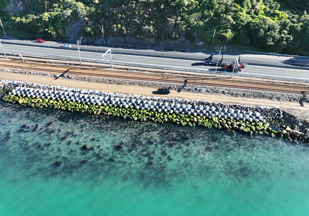
The Ngā Ūranga ki Pito-One section of Te Ara Tupua will be built along the harbour’s edge, connecting Ngā Ūranga Interchange to Honiana Te Puni Reserve in Pito-One, and linking with the new Pito-One to Melling section. The goal is to create a resilient coastal edge, protect the road and rail and provide a safe route for walking and cycling between Wellington and Lower Hutt. The Pito-One to Melling section, a 3km separated cycling route, is the first completed part of the project.
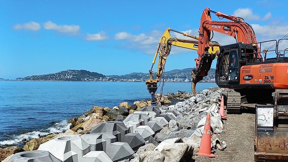
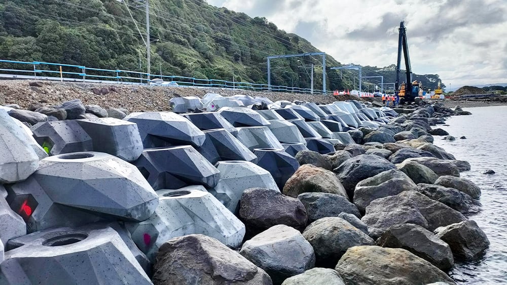
Te Ara Tupua is the first project to consider and test seismic performance in its design elements, including a new seawall built over an active faultline. The project uses rock for revetments and general fill, sourced from Taranaki and Golden Bay. XBlocPlus units, interlocking concrete blocks shaped like an ‘X’, are used to create a seawall with a steeper incline, reducing the physical footprint and impact on the marine environment. This innovation, combined with cultural and environmental design, resulted in Te Ripowai, an ecological XBlocPlus unit that encourages marine plant growth.
Overcoming roadblocks
Placing the blocks with precision and speed was initially a concern. Operators in excavators equipped with grapple attachments needed to place the units underwater with an 80 mm tolerance. The project team used Trimble® SketchUp to model the blocks and combined it with the Trimble Marine Construction (TMC) System for real-time feedback on block placement. Jan du Preez, survey manager with the Te Ara Tupua Alliance, noted, “With TMC, the operators can ‘see’ where they are placing them under the water. Because they’re working in an active tidal area with most of the blocks sitting underwater, the idea was to make the process as easy as possible for the operator with highly visual markers on the screen. Every step is color coded, which allows operators to just focus on the colors, rather than trying to see underwater with the naked eye.”
The digital workflows provide transparency to stakeholders. The Alliance model integrates the client into the project team, and regular drone flights capture progress updates. All survey data, models, and flight imagery are stored in Trimble Stratus for sharing. Du Preez mentioned, “Every time the Alliance board of directors sees our solution, they are completely blown away by what we've been doing and how we're doing it."
The Ngā Ūranga ki Pito-One pathway is on track for completion in 2026, promising a safe, connected and resilient route for walking and cycling between Wellington and the Hutt Valley.
Learn more about this exciting project in this recent GPS World article.
Solutions: