[Video] Trimble Stratus: Using the Mobile Map Add-On to Avoid Utilities and Improve Communication
Lendlease Engineering, The Northern Road Stage 3, is using Trimble Stratus Software with mobile map add-on to keep office personnel and field teams on the same page throughout the complex road reconstruction project underway in Sydney.
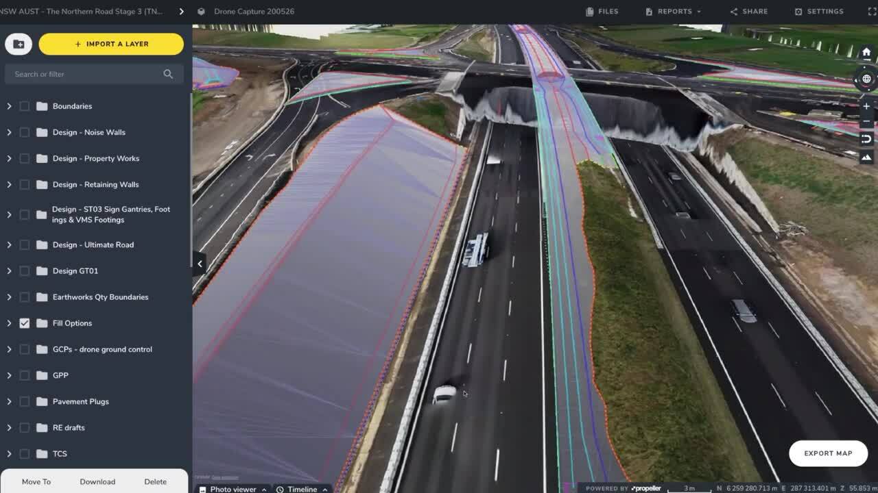
The Northern Road Stage 3, is a complex road reconstruction project underway in Sydney. It involves adding lanes to existing roads, replacing a bridge over a major roadway, and installing new everything from traffic lights to retaining walls.
In a project like this with many moving parts, fluid communication between the office and the field and well-defined processes make all the difference.
That’s why Lendlease uses Trimble Stratus with the new mobile map add-on.
We checked in with Wayne Vella, senior project engineer, and Sean Joseph, utility engineer, to see how Trimble Stratus is helping them get work done faster and more efficiently.
The Challenge
The suburban area where The Northern Road Stage 3 project is taking place is dense with utilities. Lendlease is planning work around electrical lines that feed a major hospital, a “backbone” of phone lines within close proximity to a substation, and water lines that supply the entire town.
Normally, having to circumvent these obstacles would slow operations. Construction is slowed by having to work around, or relocate, these utilities. To make sure the project stayed on track and minimize the possibility of utility strikes, Lendlease realized they needed a better way of distributing survey data to everyone on site, regardless their location.
What Were the Major Pain Points?
- Crews on site weren’t getting the information they needed quickly enough, slowing progress
- Lack of visibility on utilities left construction teams vulnerable to utility strikes
- Sean Joseph, the utility engineer for the project, had become an information gatekeeper—maps, models, and measurements that multiple parties relied on needed to be generated and shared by him
How Trimble Stratus Bridged the Communication Gap
Trimble Stratus with mobile map add-on gave Joseph and Vella an effortless way to distribute the data they’re analyzing in the office to their colleagues in the field. It provides a more seamless, efficient tool for communicating with their people out in the field. They are now better able to explain plans and deliver maps based on the most recent surveys to those on site who need them.
Previously they relied on printed plans which could easily be lost or ignored, quickly become outdated, and generally packaged the data they needed in a less convenient, usable format.
Being able to send highly accurate maps with annotated plans and design layers to their field teams’ phones, means they’re supplying everyone with more relevant, actionable information than they had access to before.
“We’re able to, almost in real time, communicate something that we’ve got in our heads to the heads of those people standing out on site.”
Wayne Vella, Senior Project Engineer
Which Trimble Stratus Features Are They Using?
- Drawing tool
Allows anyone to annotate or mark up a map
- Overlays
Designs, utility line locations, and more can be turned on and off
- QR codes
Can be sent to anyone to direct them a Crew map
No more miscommunications or data silos. Because of Trimble Stratus, Joseph and Vella are giving their teams the confidence they need to do their jobs more quickly and without fear of a utility strike.
The Lasting Impact of Trimble Stratus
In addition to the communication issues Trimble Stratus has helped resolve, The Northern Road Stage 3 project has benefitted from integrating drone surveying into their workflow as a whole.
In particular, turning drone-collected survey data into accurate, realistic 3D models of their site has saved their surveying team time they were previously using creating their own models in CAD platforms.
Trimble Stratus has also given Joseph a way to keep managers and other stakeholders informed, so that he no longer serves as a roadblock to the essential measurements and data. Anyone with access to the platform is able to log on and get the information themselves without checking in with him.
Where’s the ROI?
- By arming onsite teams with the knowledge they need to do their jobs correctly, they are able to do their work more quickly and with improved accuracy
- Having visibility on linework at all times enables them avoid utility strikes, saving money in repairs and rework
- With data more accessible to everyone in the company, office personnel like Joseph and the surveying team are able to spend less time bridging information gaps and more time performing other tasks